Fresh & Salt Water Systems

Humans depend on water supply and quality
Earth is sometimes called the water planet because 71% of its surface is water. Earth has the most water of any planet in the solar system!
Two influences on the many variations in Earth’s water supply: Natural occurrences & Human activities
Humans do not drink salt water. Humans drink fresh water that is potable
The Distribution of Water on Earth
Earth's water cycle is very important because it controls the distribution of water on Earth
Earth’s water exists naturally in different forms:
Solid (ice)
Liquid
Gas (vapour)
Water on Earth
Freshwater only makes up 3% of all the water on Earth
Of that freshwater only 1% is available for human consumption
That means only 0.3% of all the water on Earth is available for humans to drink (Also known as Potable Water). That is a tiny amount!
Why such a small amount of fresh water?
Fresh water trickles too far below the Earth’s surface to retrieve it
Fresh water is located too far from human habitats (ex. we don’t live close enough to it)
The rest is salt water which we can not drink

Water around the globe

Q: How many oceans are there?
A: Technically one! The ‘oceans’ are all connected, but we divide them further into the following:
Pacific Ocean
Atlantic Ocean
Indian Ocean
Antarctic Ocean / Southern Ocean
Arctic Ocean
Seas are smaller and not as vast as oceans, they are also not as deep as oceans. (think of seas as mini-oceans)
Ocean and seas are considered saltwater systems!
Why are Oceans so salty?

WHAT ABOUT THIS OCEAN?
Oceans and seas are fed by river water, and rain water.
When river water flows it picks up small deposits of minerals, these minerals along with the river water are eventually washed out to sea/ocean.
Q: How come river water is not salty? But it makes the ocean salty?
A: Over millions of years the rivers have been depositing small amounts of mineral salts into the ocean. Over time that small amount collects and increases the salt concentration of the oceans.
Movement of water in the oceans
Q: Why is Great Britain warmer than Edmonton?
A: The global conveyor belt of heat transports warm water to the coasts near Great Britian
Currents:
A stream of water that moves within a larger body of water.
Carries warmer & colder water to different areas
Surface water currents mainly caused by:
wind
tides
Earth’s rotation
Ex. Waves, and rip currents
Deep water currents mainly caused by
temperature differences in the water
salinity differences in the water
Earth’s rotation
Ex. Gulf Stream

A AERIAL SHOT OF A RIP CURRENT
Currents affect Temperature & Climate

OCEAN CURRENTS AND Temperature
Surface currents are caused by steady winds, this moves the water great distances.
For instance warm water from the Gulf of Mexico moves all the way to the North Atlantic which warms Europe’s climate
Warm or cold currents greatly influence the climates on land.
OCEAN CURRENTS AND PRECIPITATION
The temperature of an ocean current affects more than just air temperature; it also affects the amount of precipitation in an area.
Warm air holds more moisture than cold air.
Winds over a warm current (ex. Scotland)– warm air carries lots of water - expect rain.
Winds over a cold current (ex. Labrodor)– cold air carries little water - expect no rain.
Currents are different from waves because the water moves from place to place.
Waves

BLOWING WIND CAUSES WAVES TO ROLL ACROSS THE SURFACE OF A BODY OF WATER
Waves:
Up and down movements on the surface of all bodies of water, even small puddles, have waves!
Waves do not move water, energy is just transferred through the water as a wave. (Think of it like tying a rope to a door knob and shaking it, the rope moves up and down, but it actually doesn’t move from left to right)
Strong storms cause high winds that blows across water
Small waves are created, and combine, creating larger waves
Large waves combine to form a swell
Swells produced out at sea eventually travel to the shoreline and ‘breaks’ on the shore
Swells in open water appear to move up and down.
Factors affecting swells:
Large wind speeds
Distance the wind blows over the water (called fetch)
Time wind has blown over fetch
Effects of Waves on Shorelines
The force of waves can affect both a hard rock and soft sand shoreline.
Breaking waves regularly impact shorelines causing erosion of land surfaces.
Tides
Tides:
Daily changes in water level of the oceans.
Tidal changes are seen regularly along the coast. There are 2 high tides and 2 low tides a day:
High Tide – highest water level along the coast
Low Tide – lowest water level along the coast
Tides force are caused by:
The moon’s gravitational force is the primary cause of tides
Centripetal force causes water to bulge more at the equator
The sun also has an influence, but it is very small

MOON CREATES TIDES - FYI THIS IS NOT TO SCALE!
How does the moon create tides?
The side closest to the moon feels a strong pull from the moon creating a bulge.
The opposite side of the Earth also has a smaller bulge due to the moon pulling on Earth
The two bulges on both sides of Earth are the high tides.
People keep track of the tides with guides called tide tables.
Q: What is a Rip Tide?
A: When the tide is receding (high tide to low tide) through an estuary it can pull a large amount of water through a narrow gap, this can pull objects off into sea very quickly.

MAP OF THE EARTH IF IT WERE TO STOP SPINNING - CAUSING ZERO CENTRIPETAL FORCE - NOTICE THERE WOULD BE NO OCEAN NEAR THE EQUATOR!!!
Oceanic Basins
Processes that form Ocean Basins
The Earth is very old, and much of what we know has changed - It's 4.5 - 4.6 billion years old! (Life started 3.7 billion years ago)
The Lithosphere is the solid outer part of Earth, made of rock, which has broken into tectonic plates that are moving constantly and slowly due to convection currents within Earth’s molten core.
If we stripped the Earth of water we would see the solid outer surface of Earth (lithosphere). This outer part has high points (mountain ranges) and low points (basins).
If we were to re-introduce the water back into Earth it would to trickle down to the lowest points of the lithosphere hence filling and forming oceanic basins.
Think - oceans are the world’s sinks because of their low elevation
Examples how Water can effect the Climate
Climate:
Average weather measured over a long period of time.
The Effect of Large Bodies of Water on Climate
Water has a high heat capacity, it can hold heat longer than other substances, this prevents wild temperature swings!
Cities next to large lakes are cooler during summer, and warmer in the fall (Chicago)
Ex. Hawaii’s temperature stays relatively close to an average temp, the water of the Pacific ocean prevents it from getting very cold or very hot
The snow lake effect
Large bodies of water influence the weather and climate in their regions as well
Geography affects precipitation as well, mountains and elevations cause water in moist to be deposited.
Chinook Winds:
Chinooks are abnormally warm winds that sweep across the prairies. They are created by a rain shadow effect from the Rocky Mountains. The term comes from the chinook peoples of interior B.C.

The Rain Shadow effect
Warm moist air from the ocean moves over land
As it moves over the land it deposits most of the moisture (especially at high elevations)
What’s left is a warm dry air with very little moisture
In Alberta, the Rocky Mountains create a rain shadow, moist clouds move over British Columbia and deposit rain, once the warm air reaches the mountains it deposits what ever moisture it has left. The warm dry air continues over the mountains. In Alberta — Calgary resides in this “rain shadow”, during winter Calgary can experience Chinook winds that warm the area.

THE RAIN SHADOW EFFECT OVER NEPAL
Fresh water
Freshwater:
Naturally occurring water that lacks the salt content found in seawater.
Lakes
Rivers
Ponds
Streams
Underground aquifers

FreshWater sources
The water cycle is a cycle of processes by which water circulates between the earth's oceans, atmosphere, and land.
When water evaporates from the oceans it moves over land and deposits as precipitation:
Rain
Snow
Fog/Dew
Higher elevation land (Ex. Mountains) have lower temperatures, when clouds (water condensation) moves over elevated lands they will deposit much more precipitation. (aka - Mountains receive more rain and snow)
Rain water collects in small streams, this flow is always from higher elevations to lower elevations.
Snow also collect in large glaciers which melt throughout the spring/summer.
glaciers
Glaciers :
Large moving body of ice, glaciers can be many meters or even kilometres thick, and stores vast amounts of freshwater.
Glaciers that cover vast areas of land are called continental glaciers or icecaps.
Glaciers form in the cold regions of Earth, they build up, and then start to move, which then are called valley glaciers because they flow between the mountains.
The valley glaciers collect huge or small pieces of rocks, which drag on the surface and determine the form of the land.
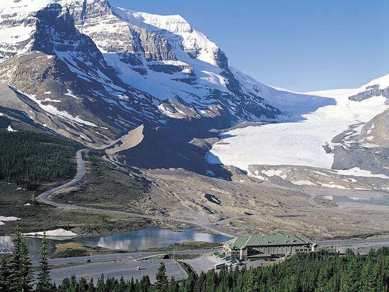
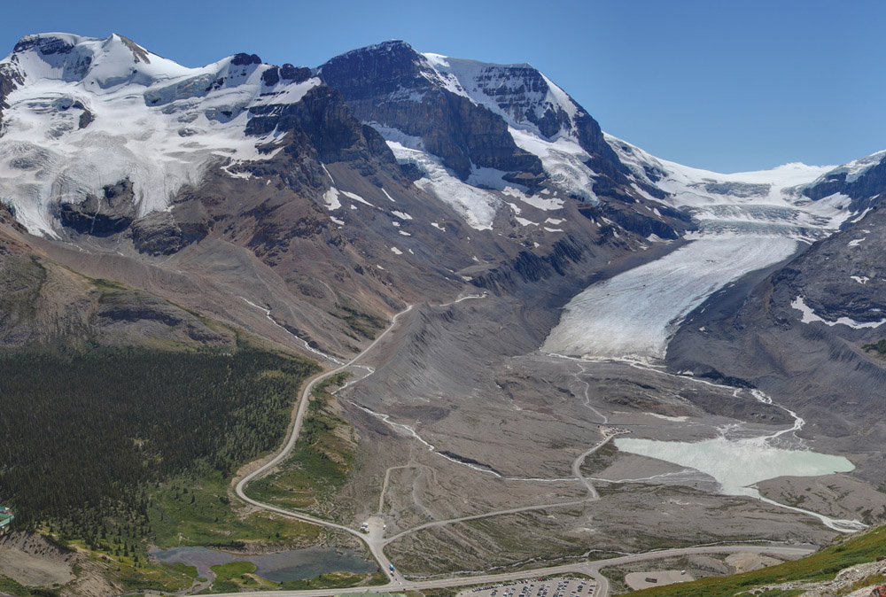
The movement of glaciers depends on the climate.
Cooler – little melting, snow builds up, and the glacier moves forward and is considered to be “advancing”
Warmer – more melting, snow decreases, the glacier moves back and is considered to be “retreating”
Recognizing Glacial Features
Today, few continental and valley glaciers cover the Earth.
In the past, large areas of the Earth were covered, called the Ice Ages.
The Ice Ages shaped most of Canada’s geography.

Glacial features include:
Moraines:
Rock deposited at the front of the glacier
Eskers:
Streams under the glacier deposit rock over time
Drumlins:
A large pile of rocks dropped by the glacier
Kettle lakes:
Tiny lakes formed by large chunks of ice left over from glaciers
What is a Water Shed?

PRIARE WATERSHEDS
Watershed :
An area of land that drains into one main lake or river.
A watershed can contain many smaller rivers and lakes.
Think of a watershed draining into a river being the same as a funnel that collects water and drains it into a pipe
The “vertical edges” of a watershed are elevated areas (Mountains / Hills)

Continental Divide :
The highest point of land on a continent; rivers flow into different oceans depending on which side of the divide they begin.
In Canada the continental divide is the Rocky Mountains.
The red line on the map divides North America into East and West.
If water rains west of the divide it will end up flowing into the Pacific Ocean
If water rains east of the divide it will end up flowing into the Atlantic Ocean
There are other divides in North America that contribute to the direction water flows
Continental Drainage Systems
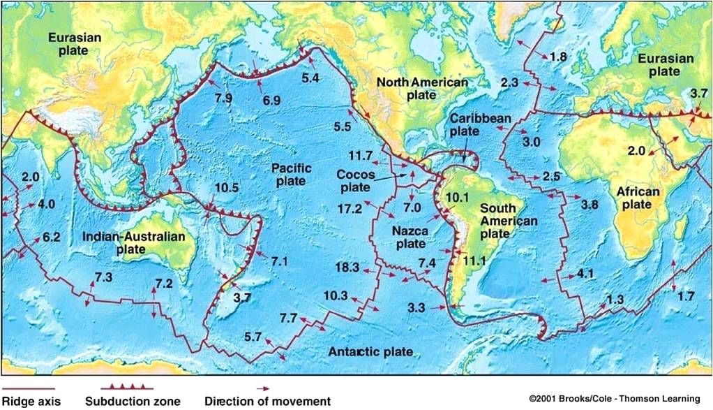
The same forces that shape the ocean basins also build the continental divides.
At the edge of the continent, two plates meet and push against each other, which cause wrinkles in the continent’s surface to push upward and form mountain ranges.
Plate tectonics have formed many continental divides.
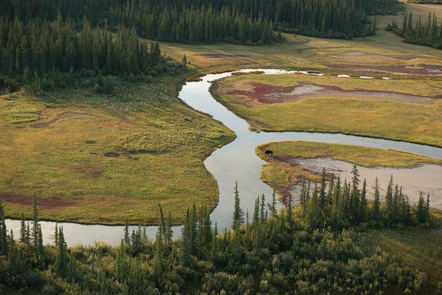
Life of a river

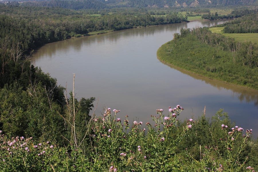
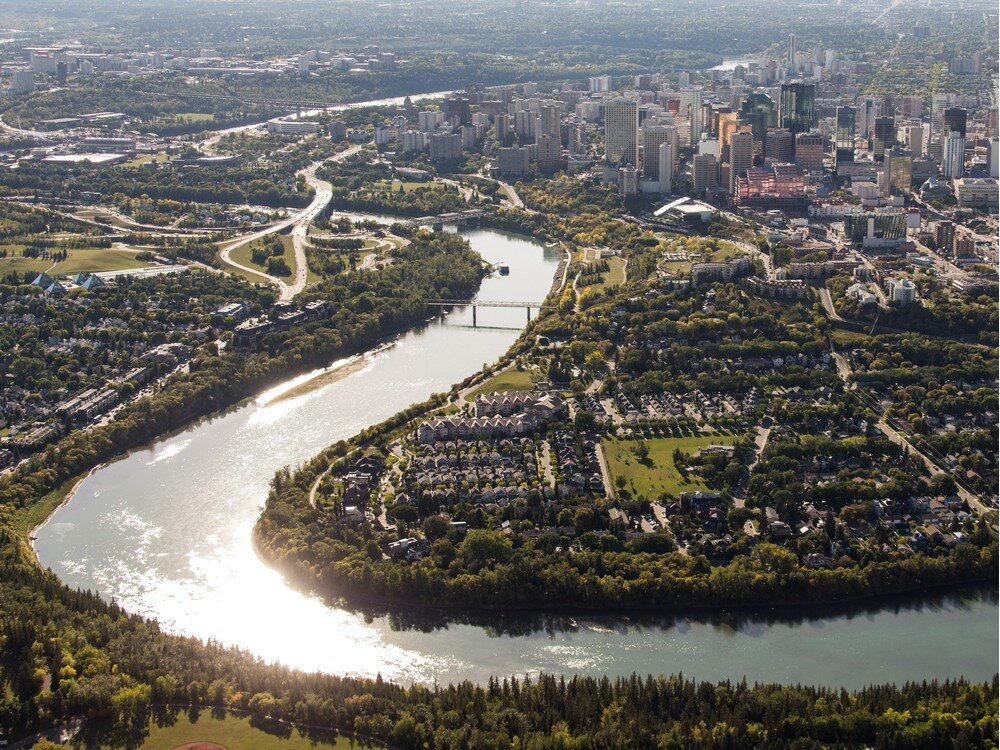
RIVER MEANDERS OVER TIME
Most streams originate in higher elevations such as mountains or high grounds
Streams steadily increase in volume of flow as they move from mountains to hills
As streams flow into lower areas, smaller streams begin to combine to form rivers
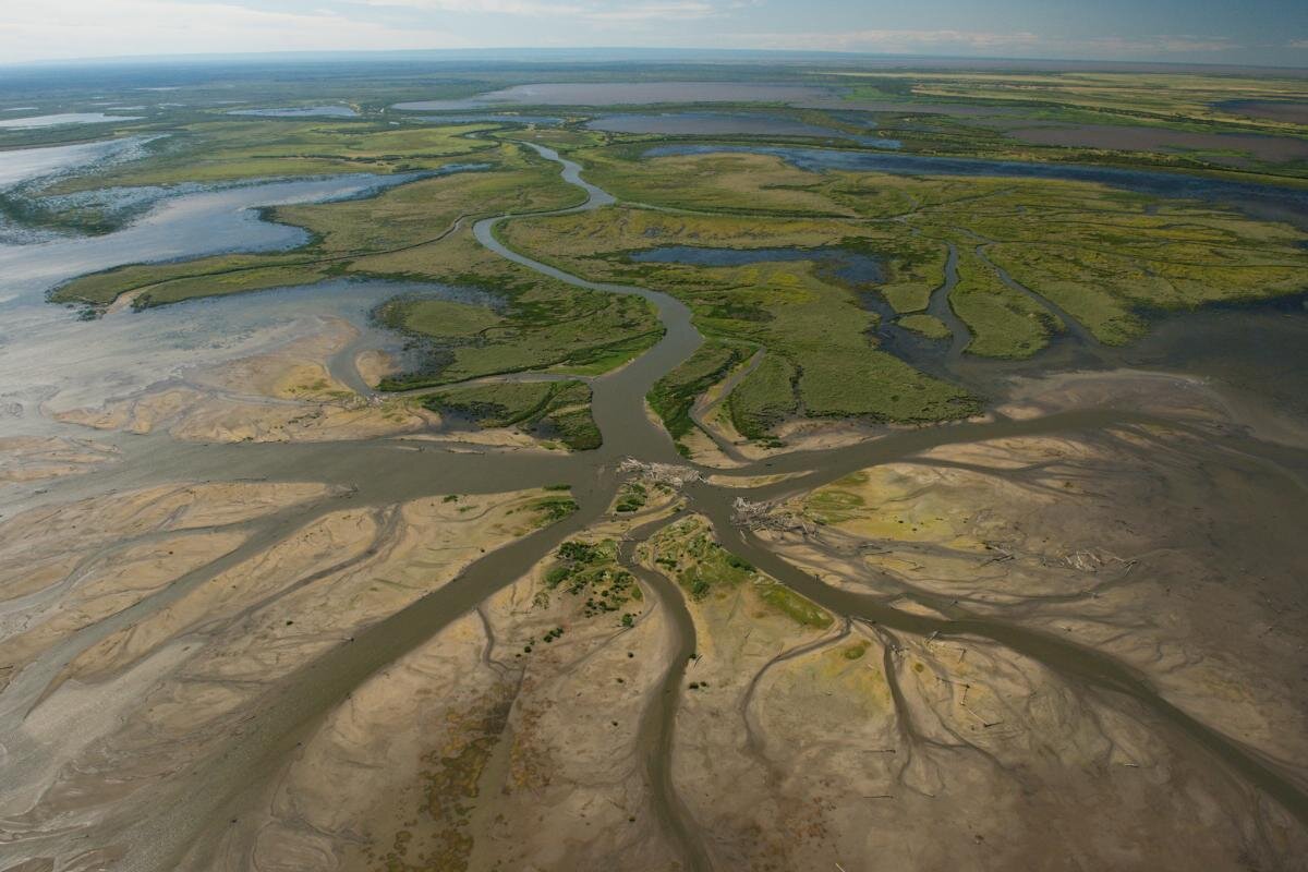
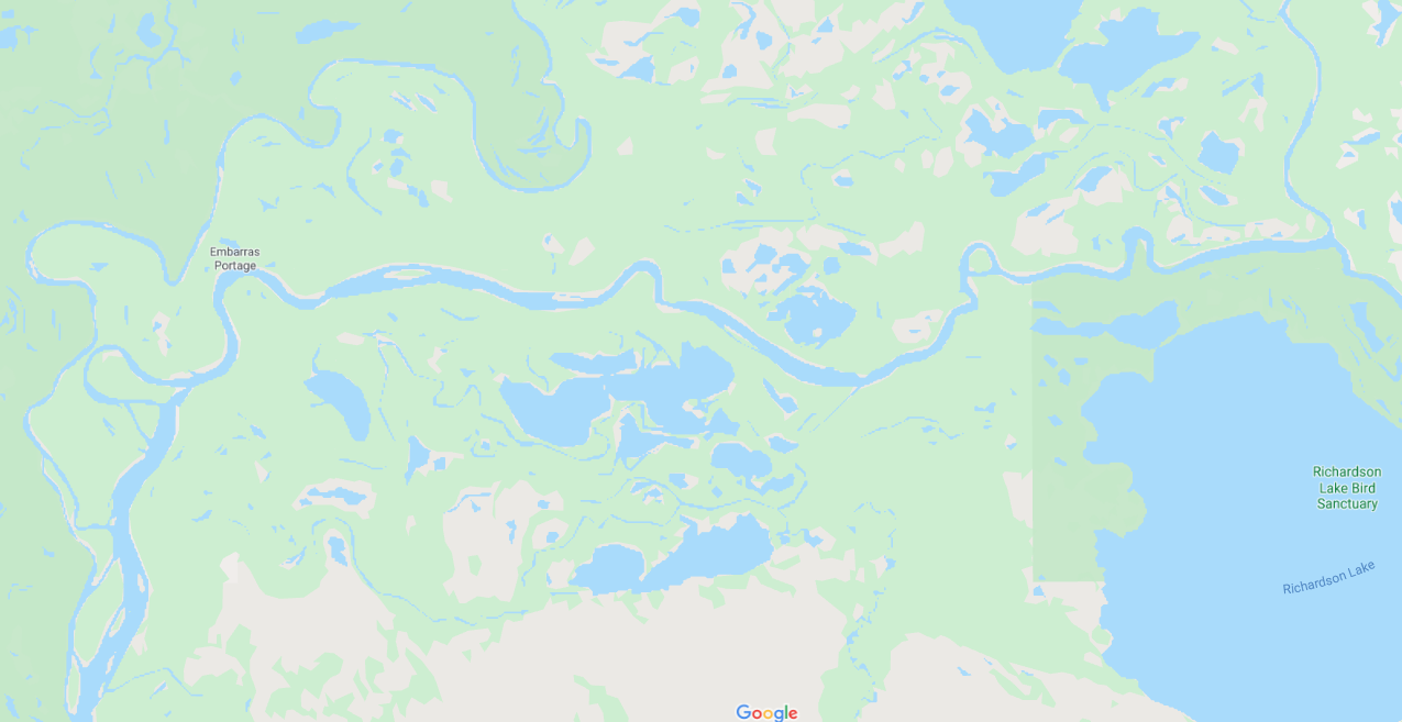
Over time rivers slowly begin to twist and turn, this erodes the nearby river banks forming valleys (river is meandering)
As river waters begin to slow the farther it travels from its source it deposits rocks and minerals into the riverbed
River eventually forms collects into a lake, or flows into the ocean
River and Stream Characteristics
Identifying the characteristics of a stream or river is useful because it helps:
Scientists understand types of organisms living in the waters.
Scientists hypothesize the impact of human activities on these waters.
Engineers use stream characteristics to understand how to build bridges and dams.

Stream zones
Erosion Zone (aka Headwaters):
Fast moving water
Large sediments enter the water
Transfer zone:
Water moving at a slower pace
sediment is moved along river
Depositional Zone:
Water moves very slowly
Sediment is deposited and collected at the bottom of the river
River Delta:
A landform created by deposition of sediment that is carried by a river as the flow leaves its mouth and enters slower-moving water (ex. lake, ocean)
Describing Stream Characteristics
Researchers organize a river or streams characteristics with a profile.
Stream Characteristics :
Characteristics used to describe a stream or river; these include:

THE CHARACTERISTICS OF A STREAM’S SHAPE
Speed of flow (how fast is the river flowing)
fast, moderate, slow, crawling
Quantity of water (amount of water flowing)
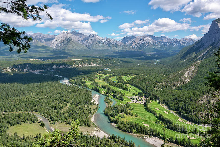
vast (Amazon River), large (North Sask. River), moderate (Bow River),
small (Elbow River), trickle (mountain brook)
Stream shape (does it flow straight or does it curve back and forth)
straight, sinuous, meandering
Stream slope (affects speed of water flow)
steep, moderate, gentle
Riverbed shape (how does the bottom of the river look)
V shaped, U shaped, flat, shallow
Stream width (how wide is the river)
wide, intermediate, narrow
Stream bank (tall steep cliffs - not much erosion, valleys eroded over time, deltas form via deposition)
cliffs, steep, deep, plateau, sloping, valleys, broad valleys, sand bars
Stream sediment size (how large are the rocks being pushed by the river)
large (dime sized), intermediate (small pebble sized), small (grain of sand), fine (grain of flour)
Stream sediment amount, also known as turbidity (more sediment creates murky water)
large amounts (Mekong Delta), moderate (North Sask. River), small amounts (Bow River)
Erosion and Deposition
Moving water is a powerful force. Waves can shape a shoreline. Rivers also shape the land they flow through.
Erosion:
The wearing away and transporting of rock fragments, soil, and sand.
Sediments:
Eroded rock fragments and soil carried by water and wind.
Sediment Load:
The amount of water-borne materials (rock, soil, organic matter) a stream carries.
Deposition :
The laying down or depositing of sediments.
A river’s sediment load is the amount of water-borne materials that it carries.
The faster the water moves = the more the water can carry.
Chemical Weathering:
Water reacts with chemicals to dissolve rock
Water and carbon dioxide for carbonic acid
Hydrolysis - water reacts with minerals present in the rock (ex. Feldspar rock into clay minerals)
Oxidation - oxygen reacts with minerals present in the rock (ex. rust)
Water characteristics
Water Testing Criteria
A simple and common method of testing is appearance and smell, but this should be used cautiously because many dangerous organisms will not be detected.
Colour & cloudiness
Dissolved salts and minerals
Toxic substances
Bacteria
pH
Even taste
Water Quality
Water Quality :
A measure of the amount of substances besides water in a water sample; OR description of how pure a water sample is.
Water in nature is never pure it always contains organisms, organic material, minerals, and other dissolved chemicals.
Potable Water :
Water that is safe for human’s to drink. Potable water also pertains to other organisms.
Substances Dissolved in Water
Dissolved minerals in water can create different hues that change the colour of water.
Lake Louise has green-turquoise water due to glacier meltwater that contains minerals and “rock flour”, the sunlight bouncing off these particles gives it that green-turquoise hue.

LARGE AMOUNTS OF MINERALS ARE FOUND IN THE WATERS OF LAKE LOUISE
Fresh water found in nature is full of dissolved minerals which can affect a water’s taste, pH, oxygen content, and toxicity!
Most of the substances dissolved in fresh and salt water are called salts.
Most common salt is sodium chloride (NaCl) - same chemical as table salt.
Salinity:

HOW SALTY IS THIS OCEAN?
The amount of dissolved salts in a body of water
Not potable! Humans can not drink salt water!
(ex) Seawater (3.5%) has a higher salinity than fresh water.
The Atlantic ocean is the saltiest ocean, the Mediterranean sea is even more saltier than the Atlantic ocean!
Other “Salts” dissolved in water
As fresh water flows from Earth’s surface and underground it dissolves minerals from the soil and rocks. One of these calcium carbonate.

SOAP TEST FOR HARD WATER
Hard Water :
Water containing a high concentration of mostly calcium and magnesium, can sometimes include iron. Soap does not bubble up in hard water (soap test)
Potable — safe for consumption
Groundwater well sources
Soap does not lather in hard water
Leaves white deposits of limescale
Can appear cloudy
Tastes good (at least I think)
Soft Water:
Water containing little or no calcium or magnesium content is considered soft water.
Potable — safe for consumption
Rain water
Soap lathers and rinses better
Does not leave white deposits of limescale
Appears clear
Tastes bland!
Video Hard vs. Soft Water

Dissolved minerals can affect the taste of the water, some examples:
1) “Salty” fresh water in the prairies
2) Iron in the fresh water in Ontario
3) Hard water across Canada

Removing the effects of hard water
DISSOLVED TOXINS
Water can also carry dissolved chemicals that are harmful to living things
Depending on the water source, water can contain significant amounts of the following toxins:
Lead
Arsenic
Mercury
Copper
Radium
Sulfur
Pesticides
Bacteria in Water
Water has many living things in it, microscopic bacteria included! Most bacteria is harmless to human consumption but some can be very harmful to human health.

Organisms in Drinking Water
Fresh water also contains organisms and organic matter.
Harmful bacteria in water include:
Escherichia coli (E. coli) cause stomach cramps, diarrhea, and possible death
Salmonella - popular cause of “food poisoning”, stomach cramps, diarrhea, fever
Gardia cause diarrhea, lot’s of it. Also causes “beaver fever”
Shigella cause dysentery, bloody diarrhea, fever
Thankfully human treatment processes eliminates bad bacteria via chlorination and filtration, but outbreaks could still occur!
pH OF WATER
pH scale:
pH is a scale that measures how acidic or basic a solution is. (Yes it begins with lower case ‘p’)
Scale from 0 - 14.
pH 0 = very strong acids
pH 7 = neutral
pH 14 = very strong base
Usually humans want to ingest water that has a pH between 5.5 - 7.5
Acid → think lemon juice (sour) pH around 3
Slightly acidic → think coffee pH around 5.5
Neutral → think tap water (not sour, or bitter) pH around 7
Slightly basic → think tums (bitter) pH around 8
Base → think green tea (bitter) pH around 9
pH of water can affect the minerals dissolved in water, while minerals in water can also influence the pH of water

Universal indicator is a substance that can be added to a solution to check pH of the solution. The pH of the solution will create a colour change in the solution.

Water Quality Testing
Water from a well is rarely treated because its location far underground protects it from most natural and human activities. However, airborne pathogens may still come in contact with water
City water is always treated because it comes from surface locations (rivers and lakes) which are highly susceptible to pollution. Treating the water is important to bring up the quality so that it is potable.
Water is treated using filters, coagulants, disinfectants, and fluoride.
Making potable water
Due to the high salinity of most of the Earth’s water, the salt must be removed in order to make the water potable.
Removal of salts via either distillation or reverse osmosis

A SIMPLE DISTILLATION SET UP
Distillation :
Technique for separating solutions that involves boiling and condensation.
1.Salt solution in a flask is heated until water vapour (gas) rises up from the flask
2.Water vapour (gas) condenses on the inside of the horizontal tube forming small droplets (liquid)
3. Horizontal tube collects droplets as distilled liquid water
Advantage:
Water does not contain any undesirable contaminates like dissolved solids or chlorine.
Contains pure water!
Can be powered by the sun
Disadvantage:
Removes the dissolved gasses that give water its pleasant taste -- distilled water tastes "flat.“
Requires a lot of energy
Reverse Osmosis :
Movement of water through a membrane from a high concentrated solution to one of lower concentration solution
Recall osmosis is the movement of water particles through a permeable membrane from a less concentrated solution into a more concentrated solution (Water moves from less ‘salty’ to more ‘salty’ solution)
Use pressure from pumps to force a solvent (in this case salt water) through a membrane that retains the solute (in this case salt) on one side and allows the pure solvent to pass to the other side (Water is pushed by a pump through permeable membrane, salt stays on one side of membrane, fresh water enters the other side of the membrane)
Used mainly in desalination
Advantage:
Turns saltwater to potable water.
Disadvantage:
Expensive to run pumps, lots of electricity!
Environmental impact. Water is filtered at the cost of large quantities of waste water. For every 20L of output, a typical residential reverse osmosis filter will send around 40 - 80 L of water down the drain.

Stream Characteristics Profile Assignment
Using the stream characteristics criteria that you have learned in this unit take a look at following three rivers below. Observe and profile each river using the template provided.
Athabasca River
(Buffalo Wood National Park)
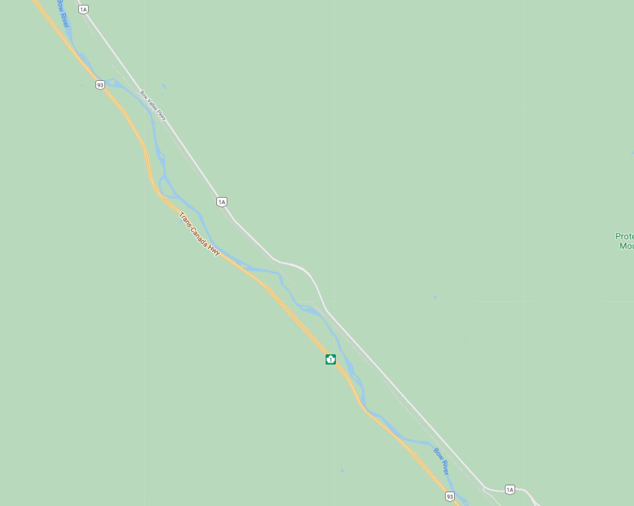
Bow River
(Banff National Park)

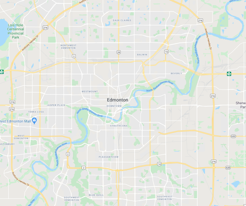
North Saskatche-wan River
(Edmonton)